The Growing Demand for Efficiency in Development Projects
Efficiency is now the cornerstone of successful architectural projects. With growing pressure on project managers to deliver more with less, the focus on maximizing efficiency by minimizing resource use while optimizing outputs has never been greater. Clients are now more vigilant, closely monitoring the use of time and resources to ensure that every penny and minute is well spent.
In this high-stakes environment, project teams face the daunting challenge of demonstrating value. They must skillfully balance costs, timelines, and customer satisfaction while maintaining high standards of quality. This balancing act often involves adopting clear communication and robust resource management strategies, which are essential for improving project efficiency.
In the competitive fields of urban planning and commercial development, a dedicated team that excels in these areas can make all the difference. The need for innovative tools and strategies to support these efforts has led to the rise of aerial 3D renders, which offer a fresh perspective on project visualization and planning for residential or commercial spaces.


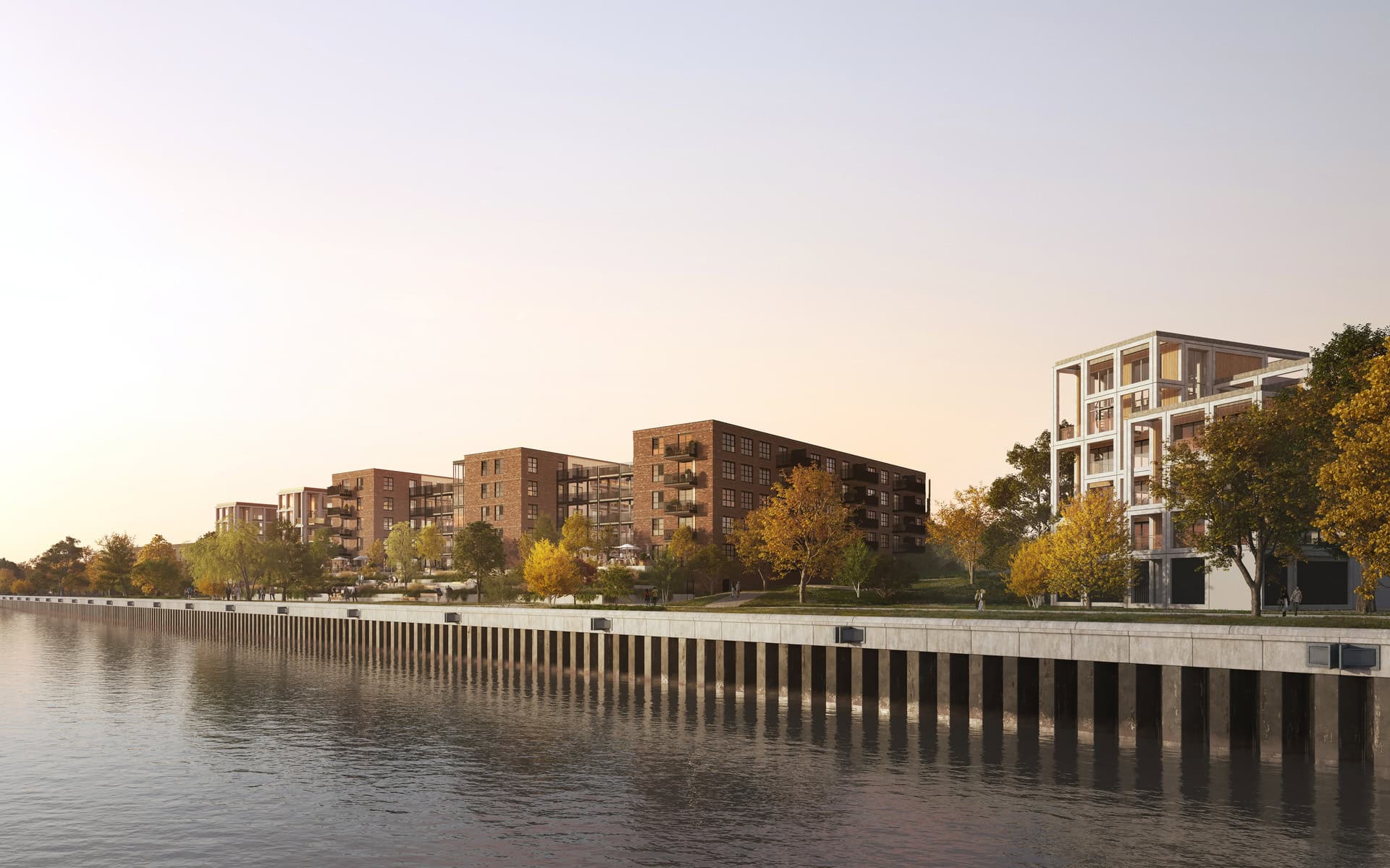
Residential living at Kloos Alblasserdam, Netherlands / Architects and developers: FSD x Bosch und Slabbers x Van Aken / 3D aerial view renderings crafted by RNDR
What are Aerial 3D Renders?
Aerial 3D rendering is a cutting-edge form of architectural visualization that creates three-dimensional visual models of architectural designs from an elevated viewpoint, simulating aerial perspective typically seen from aircraft or drones. These renders provide a bird’s-eye view perspective of projects, allowing stakeholders to see how a structure integrates with its surrounding buildings and environment on a grand scale. By incorporating natural elements and offering varying camera angles, these renders enhance realism and context, making it easier for viewers to visualize the project within its surrounding landscape. Whether it’s a bustling urban landscape or a serene natural setting, enhancing the overall impact with aerial scene rendering of the development makes a difference in design communication, architectural project presentation, and property marketing.
These aerial renderings come in three main types: photorealistic, conceptual, and storytelling. Photorealistic aerial renders focus on realism and detail, creating lifelike images of architectural projects. Conceptual aerial renders help urban planners visualize different design scenarios and spatial relationships, while storytelling renders allow users to understand the story behind its aesthetic appeal, enhancing engagement and understanding of the design.

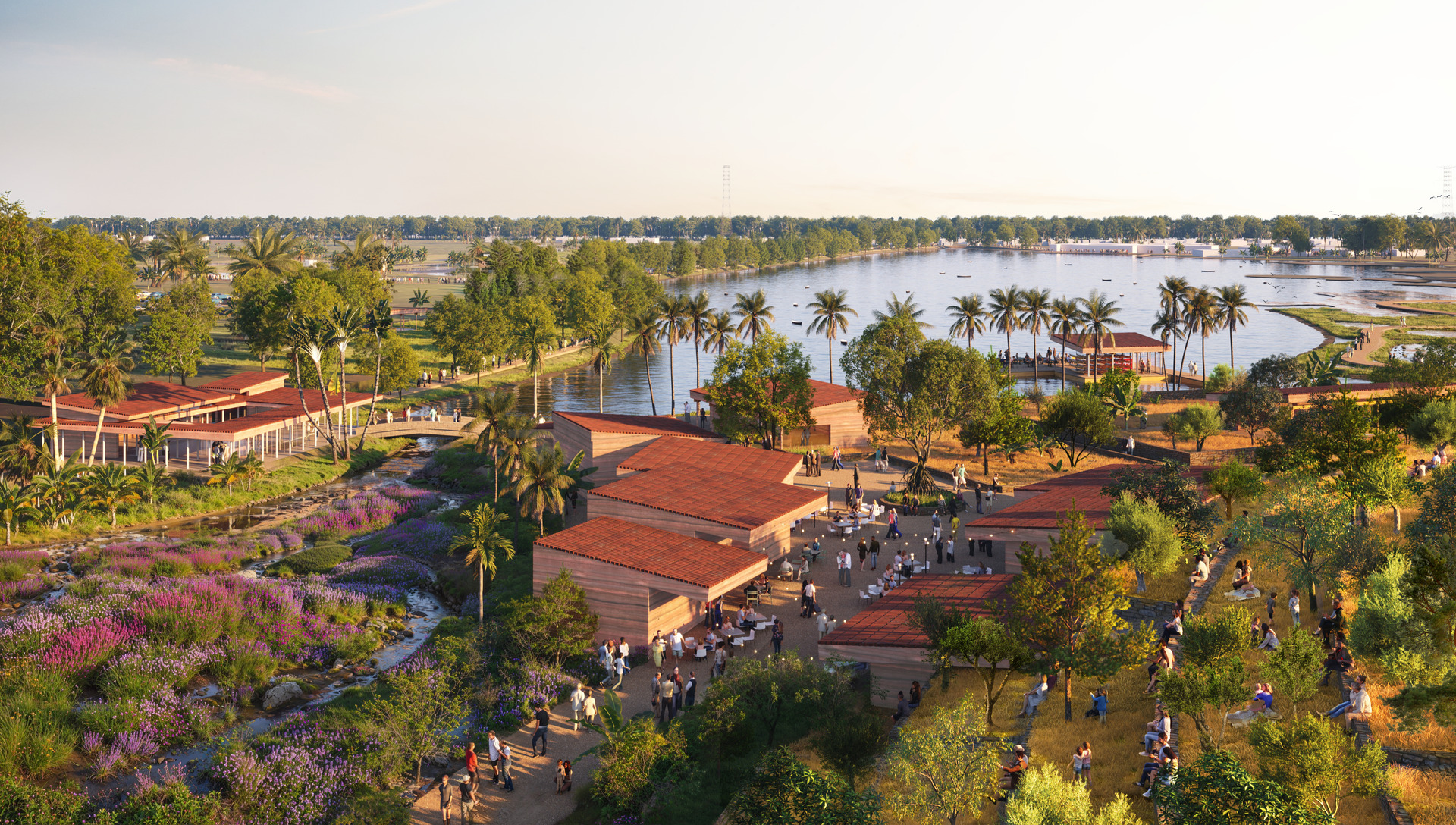
International architectural competition / Tartu Downtown Cultural Center ‘Kultuuripark’, Estonia / Architects and urban planners: Sterling Presser + WEST8 / 3D aerial view rendering crafted by RNDR
The Role of 3D Aerial Renderings in Modern Development
3D aerial renderings play an indispensable role in modern development by significantly enhancing the visualization of architectural projects and landscape design from a bird’s-eye view perspective. They provide realistic representations of landscape designs, urban areas, and future buildings, aiding in planning and decision-making processes. These renders bridge the gap between concept and execution, and their use as a presentation tool marks a significant shift from traditional technical plans to comprehensive views in 3D.


1st prize architectural tender / Homerustoren, Netherlands / Real estate professionals: Loostad x Klunder Architecten / 3D aerial renderings with surrounding landscape crafted by RNDR
#1 Bridging the Gap Between Concept and Execution with Aerial CGI
Aerial CGI translates architectural concepts into visual formats, enabling stakeholders to better understand and evaluate designs. These high-quality visualizations improve communication between architects and clients, ensuring that everyone involved has a clear understanding of the design intentions. By presenting designs from elevated viewpoints, these renders showcase how structures integrate with their surrounding environments, providing a complete overview that simplifies complex design elements for stakeholders.
Moreover, these renders serve as visual impact marketing tools by showcasing projects in a way that bridges the conceptual phase with tangible outcomes. They generate interest and investment before construction begins, helping to secure the necessary funding and support for the project. Integrating aerial renderings in development presentations captures stakeholder interest and enhances the communication of architectural concepts.

Sustainability image of the future / Architect: Sweco / 3D aerial view rendering crafted by RNDR
#2 The Shift from Technical Plans to 3D Aerial Perspective Renders as Presentation Tool
Shifting from traditional technical plans to 3D aerial perspective renders marks a significant evolution in architectural presentations. These renders allow for more engaging and comprehensive showcases of projects, providing a realistic view that traditional drawings simply cannot match. With drone photography, these aerial renders capture intricate details, resulting in highly realistic architectural visualization of urban context that enhances visual communication and stakeholder engagement through drone rendering.
Aerial renders improve decision-making by enabling visual assessments of design impacts and interactions within the surrounding environment of residential or commercial spaces. Incorporating aerial renderings into marketing strategies significantly boosts engagement with potential clients and investors.
The use of photomontage of drone footage with digital models offers a striking, realistic representation of projects, making them more appealing and easier for all stakeholders to understand.


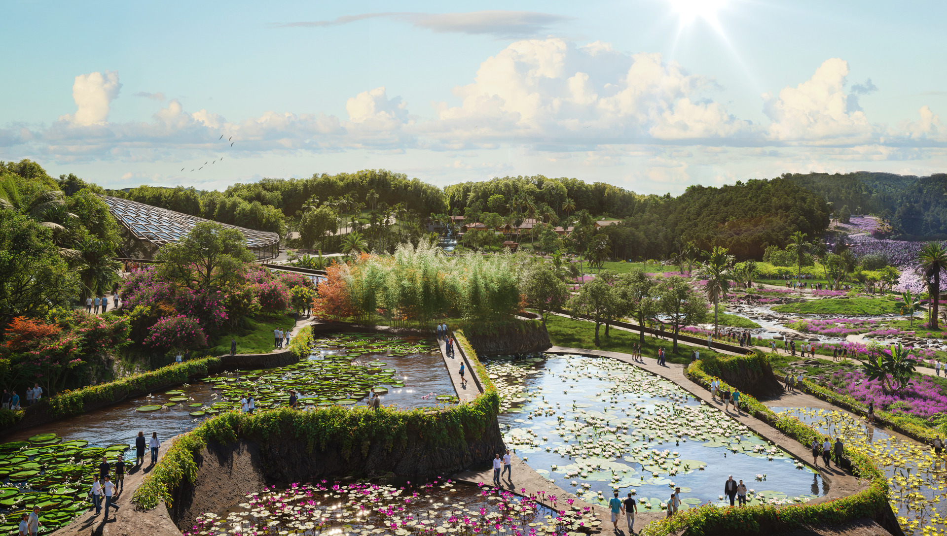
Botanical garden master plan at Kadambur, near Maraimalai Nagar, Chengalpattu District, Tamilnadu, India / Landscape and urban planner: WEST8 / 3D aerial view renderings crafted by RNDR
Key Benefits of Aerial and Drone Renderings in Development Processes
Aerial and drone renderings offer a multitude of benefits in development processes, from enhancing communication and speeding up approvals to smarter planning and better decision-making. These benefits are crucial for real estate developers and urban designers looking to streamline their projects and ensure successful outcomes.
#1 Faster Approvals with Bird’s-Eye View: Enhancing Communication with Authorities
One of the most significant advantages of using bird’s-eye view renders is the facilitation of faster project approvals. These aerial view renderings help clarify project intentions, making it easier for authorities to visualize and approve plans. By visually demonstrating how a project complies with zoning and planning regulations, aerial view 3D renders streamline the approval process and reduce the ambiguity found in traditional blueprints.
Effective communication among developers, architects, and stakeholders ensures a shared understanding of the project’s unique features and surrounding buildings. Visual representations through bird’s-eye view architectural renderings streamline discussions with authorities, making it easier to convey project intentions. This enhanced communication significantly improves the understanding of projects for clients and regulatory bodies, making it easier for them to approve designs.

Broomy Bridge in Berlin, Germany / Architect: Sterling Presser Architects + Engineers / 3D aerial rendering created by RNDR
#2 Smarter Planning: Identifying Challenges Before Construction Begins
Aerial renderings allow developers to spot potential design flaws and conflicts well before any physical work starts. By visualizing site layouts and spatial relationships, planners can foresee potential construction challenges and address them proactively. This early identification of issues helps streamline planning and logistics, ensuring a smoother construction process.
Utilizing 3D aerial renders enables project teams to evaluate site conditions and make informed decisions before initiating construction. The insights gained from these aerial views provide a comprehensive understanding of landscape challenges that might impact construction, allowing for proactive solutions.

Beurskwartier, new city center in Utrecht, Netherlands / Urban planners: Urbanext + Utrecht Municipality / 3D architectural aerial rendering crafted by RNDR
#3 Better Decision-Making: Insights for Developers
Insights from bird’s-eye view renderings assist developers in making informed choices about project execution and resource allocation in a more complex way than ground-level shots. These renders provide developers with critical insights into design flaws and site dynamics, supporting more informed decision-making throughout the project lifecycle. Additionally, aerial renderings result in significant cost savings during construction by identifying potential issues early in a project’s planning phase.
Incorporating contextual details in aerial view architectural visualizations can improve the integration of new designs within existing environments, facilitating better decision-making based on real-world settings. These bird’s-eye view visualizations streamline communication among project stakeholders, enhancing collaboration and leading to more effective decision-making processes.

1st prize tender / Langeweg Hoek, residential complex, Netherlands / Architectural project: Groosman Architecten x LAP Landscape & Urban Design / 3D aerial view rendering crafted by RNDR
Boosting Marketing and Investor Confidence with Aerial 3D Renderings
Aerial 3D renderings are invaluable for boosting real estate marketing efforts and investor confidence. Aerial scene renderings offer compelling visual narratives that capture the essence of a real estate project, making it more attractive to potential investors and buyers.
These aerial renderings enhance property marketing, design communication, and presentations through unique perspectives of architectural designs, making them more engaging and easier to understand.
#1 Engaging Stakeholders with Captivating Aerial 3D Rendering Presentations
Aerial 3D renders serve as effective communication tools that simplify complex project details for diverse stakeholders, ensuring everyone has a clear understanding of the proposed developments and architectural designs. These visually striking final renderings not only captivate stakeholders but also clarify project details and context, providing a comprehensive overview of the project and its relationship with the nearby environment.
The use of aerial rendering services is particularly effective for large-scale developments, showcasing features like accessibility and proximity to key landmarks. Quality aerial renderings in development presentations can significantly enhance marketing strategies and engage potential clients and investors.
Integrating these high-quality images into investment presentations creates a compelling narrative that captures stakeholder interest and facilitates effective communication of design concepts.

King Road master plan, Saudi Arabia / Architect: PARALX / 3D architectural aerial rendering crafted by RNDR
#2 Increasing Pre-Sales and Attracting Investors with Storytelling Aerial 3D Renderings
Storytelling through detailed aerial renderings can significantly boost investor confidence by creating a realistic preview with different camera angles of the completed project, highlighting its potential value and market appeal. These compelling visual narratives, through architectural visualizations, effectively convey the vision of a project, driving pre-sales and building investor enthusiasm. Engaging presentations utilizing 3D visuals can significantly enhance project confidence and attract investments.
High-quality 3D aerial renderings are crucial for differentiating properties in a competitive market. Utilizing storytelling through aerial scene renderings allows real estate professionals to present lifestyle narratives that resonate with potential buyers and can lead to quicker sales. These visual presentations through aerial scene rendering effectively convey architectural concepts of public, residential, and commercial spaces, significantly increasing buyer interest.

1st prize pitch / Meerstad Groningen: 28 dwellings in the forest, Netherlands / Architects and landscape architects: Bemog Projektontwikkeling x LAP Landscape & Urban Design x MIX architectuur B.V. / Collaboration: Bureau Meerstad / 3D aerial view rendering crafted by RNDR
Why Aerial Rendering Services are the Future of Fast-Track Development
Aerial 3D renderings offer a comprehensive view of projects, integrating the project’s infrastructure and surroundings and enhancing decision-making and planning through visual impact. Feedback from these architectural renderings allows architects to identify potential issues that may not be apparent in traditional plans. The ability to modify architectural aerial renderings expedites the development process, making adjustments more efficient than conventional methods.
With professional bird’s-eye view architectural renderings, stakeholders can gain a realistic understanding of projects, which can enhance approval rates and support from the community. These bird’s-eye view renderings facilitate better collaboration among team members by providing a shared visual reference that reduces miscommunication.
The future of fast-track development lies in the seamless integration of these advanced visual tools, ensuring projects are not only completed faster but also with higher precision and stakeholder satisfaction, paving the way for future building.
Bird’s-eye view renderings influence the development landscape by providing faster, smarter, and better ways to plan, execute, and market projects. From enhancing communication and securing faster approvals to smarter planning and better decision-making, these advanced visual tools are indispensable for modern development.
As we look to the future, the integration of aerial 3D renders will continue to drive efficiency and innovation in the architectural and construction industries.
Seeking Expert Help for Captivating 3D Aerial Renderings?
Contact us by clicking below and provide your project details to get started.

